https://doi.org/10.1016/j.compenvurbsys.2026.102436
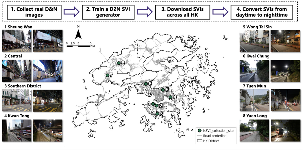
Addressing the critical lack of high-resolution nighttime visual data and spatiotemporal adaptability in existing spatial frameworks, this paper proposes an integrated computational pipeline combining generative visual synthesis with causal-spatial machine learning. Using a CycleGAN model fine-tuned on local Hong Kong imagery, the authors generated citywide, realistic nighttime street views to capture localized illumination and visibility metrics. These features were coupled with Double Machine Learning (DML) and a geographically weighted causal random forest to identify localized causal relationships. Key findings show that dense visual clutter amplifies pedestrian crash risks, whereas distinct spatial boundaries and balanced light contrast mitigate hazards. Crucially, the targeted visibility of walking paths offers stronger safety protection than overall ambient brightness, indicating that over-illumination can actually increase pedestrian vulnerability.