-
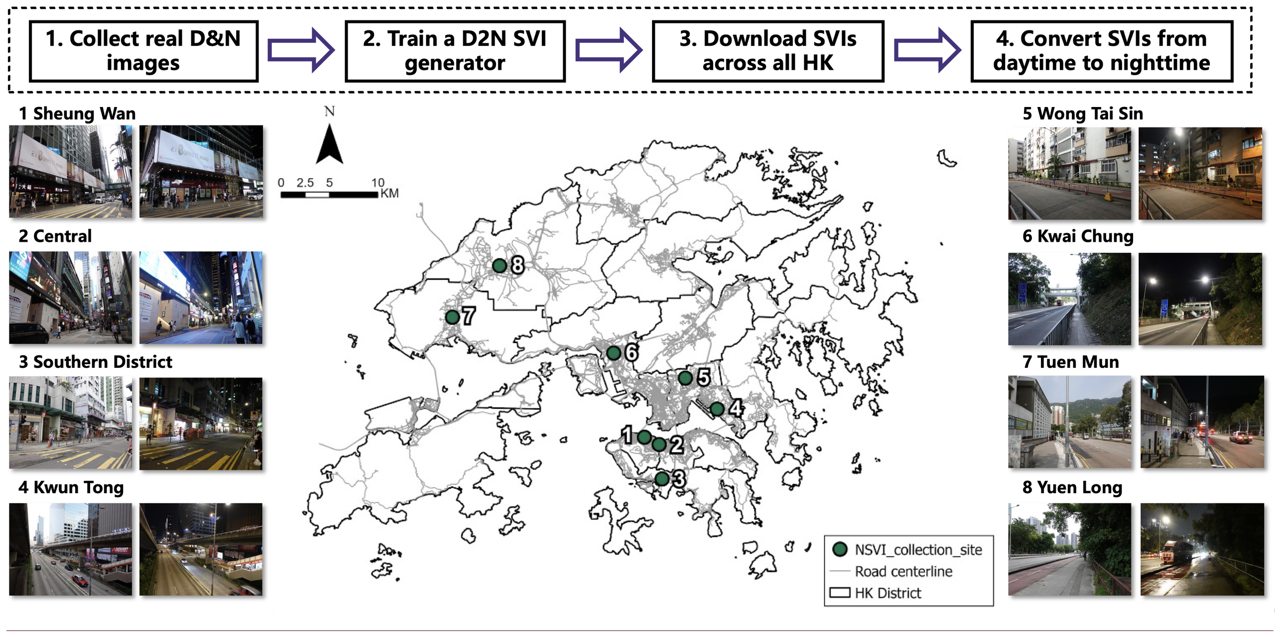
https://doi.org/10.1016/j.compenvurbsys.2026.102436 Addressing the critical lack of high-resolution nighttime visual data and spatiotemporal adaptability in existing spatial frameworks, this paper proposes an integrated computational pipeline combining generative visual synthesis with causal-spatial machine learning. Using a CycleGAN model fine-tuned on local Hong Kong imagery, the authors generated citywide, realistic nighttime street views to capture localized illumination and…
-
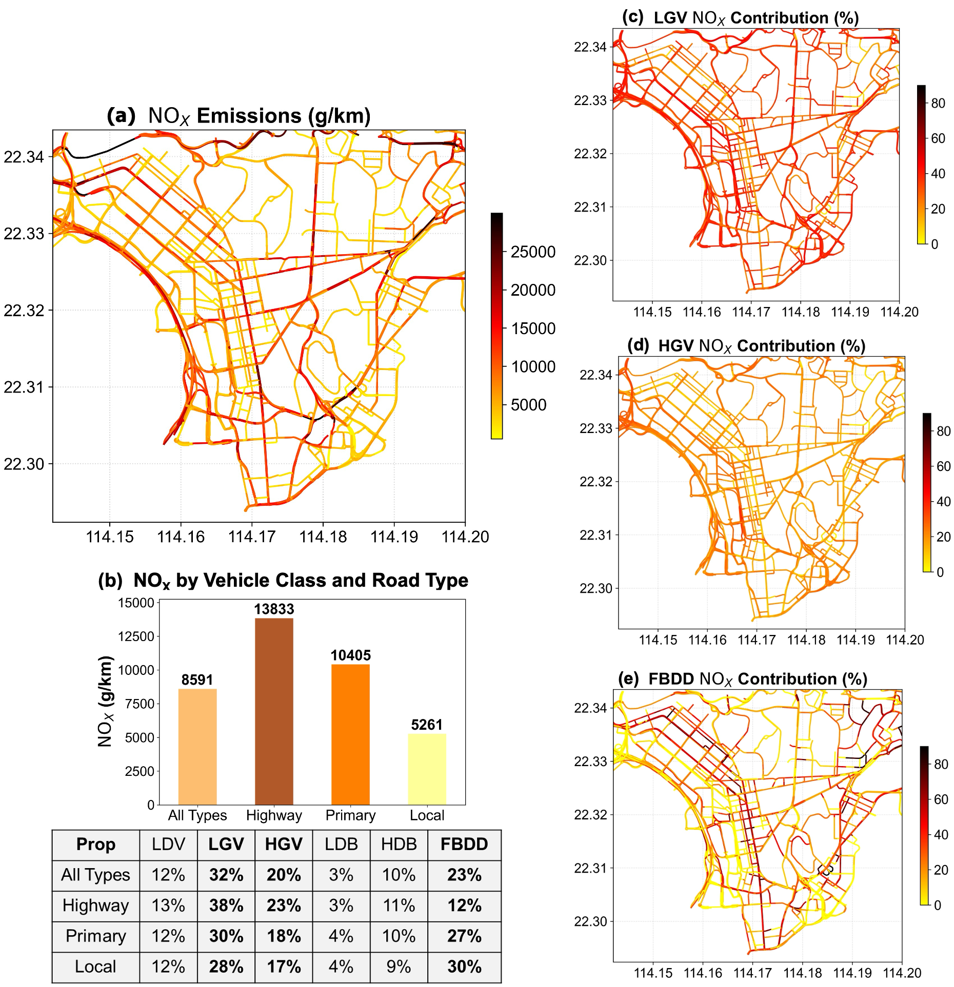
https://doi.org/10.1021/acs.est.5c14619 Traffic emissions are unevenly distributed in dense cities, contributing to traffic-related environmental inequality. Addressing this issue requires identifying which vehicle fleets disproportionately drive these disparities and how their impacts vary throughout the day. In this study, we integrate high-resolution traffic counts, traffic images, detector data, machine learning, and computer vision to estimate hourly road-segment-level…
-
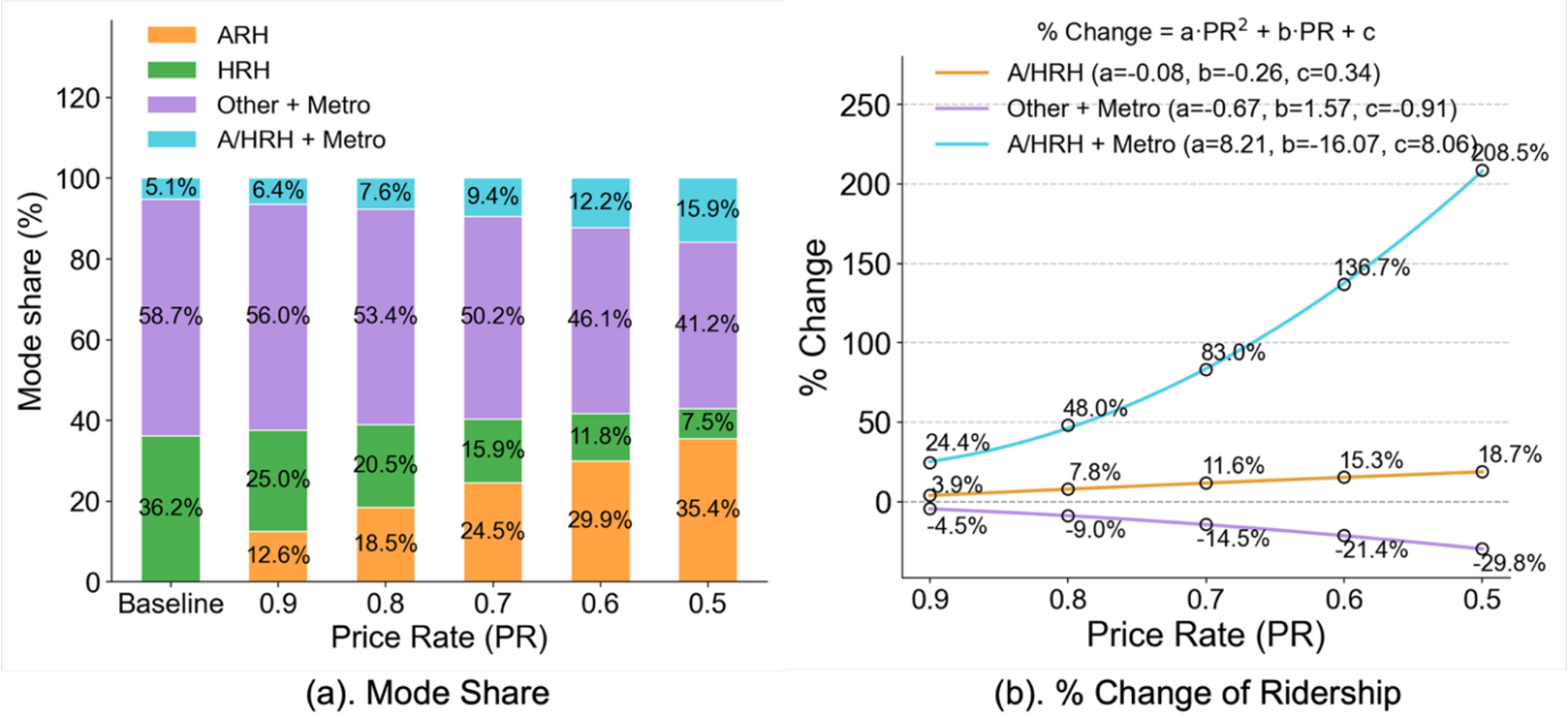
https://doi.org/10.1016/j.jtrangeo.2026.104676 As autonomous ride-hailing (ARH) services such as Waymo and Tesla’s Cybercab become more widespread, their pricing strategies will play an important role in shaping urban travel. This study examines how ARH pricing influences travelers’ choices between ride-hailing and public transit, and the resulting impacts on travel efficiency, emissions, and equity. We find that lower…